“Nature Trail Badge Challenge!” recommends six hiking trail routes for participants to visit and complete designated tasks. These routes are all at locations where The Green Earth’s “Repair Your Own Trails” volunteer team has carried out trail maintenance. We hope that through this activity, more nature lovers in Hong Kong can learn more about the stories behind hiking trails. Hence, spread the achievements of our efforts, and encourage everyone to take action to give back to nature and cherish these trails.
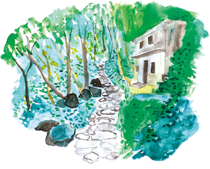
Ma On Shan Country Trail
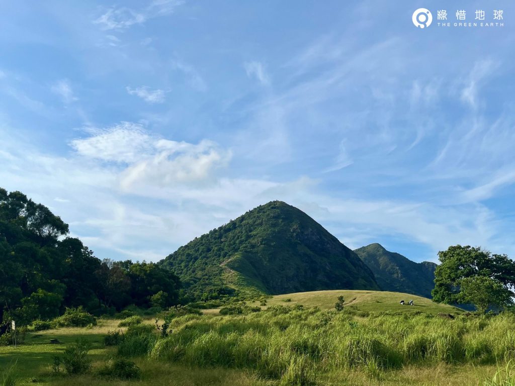
Ngong Ping Plateau is one of the few upland grasslands in Hong Kong. Standing on the green grassland, panoramic view of the Sai Kung Inland Sea and the Sai Kung Peninsula. Ma On Shan Country Trail is the most popular trail to reach the Ngong Ping Plateau. Connected with MacLehose Trail Section 4, Ma On Shan Country Trail attracts many visitors throughout the year. Ma On Shan used to be an important iron ore mine in Hong Kong, mainly for magnetite, while Ma On Shan Village was a mining village. Although the mine closed in 1976, the Grace Youth Camp in the village is now dedicated to serving the small community on the mountain and preserving the mining history and memories of the past century.
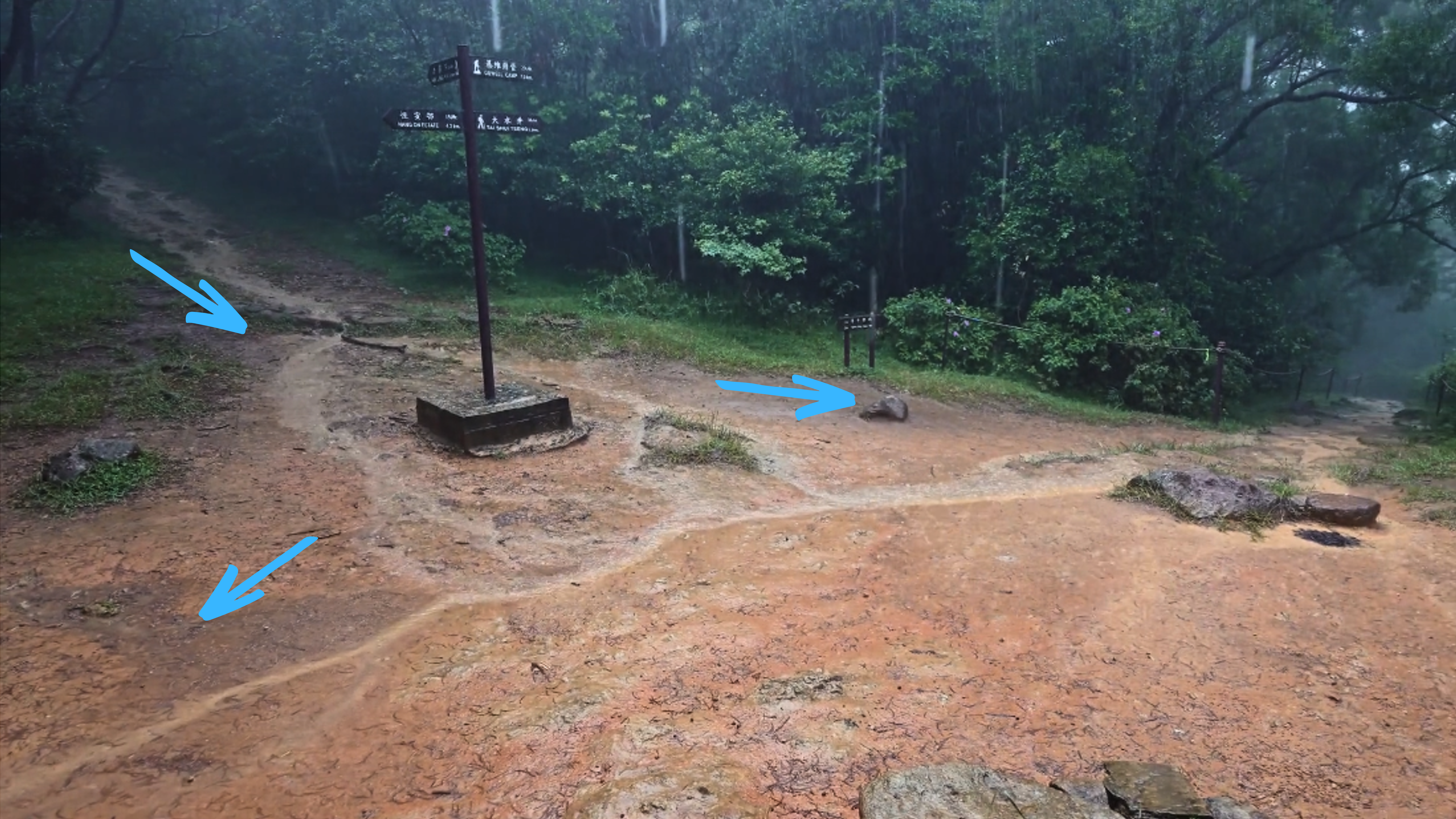
Ma On Shan Tsuen Road➡ Ma On Shan Country Trail➡ Ngong Ping Plateau➡ Tai Shui Tseng, Sai Kung
Distance: 3.5 km
Duration: About 2.5 hours
Difficulty:★★☆☆☆
Supply Point:N/A
Safety reminders:
Mobile phone signals may not be available on some sections of the trail. For your safety, please plan your trip and prepare adequate resources before setting off.
Not recommended after heavy rain due to possible water run-off from a stream near the lower section of the Ma On Shan Country Trail.
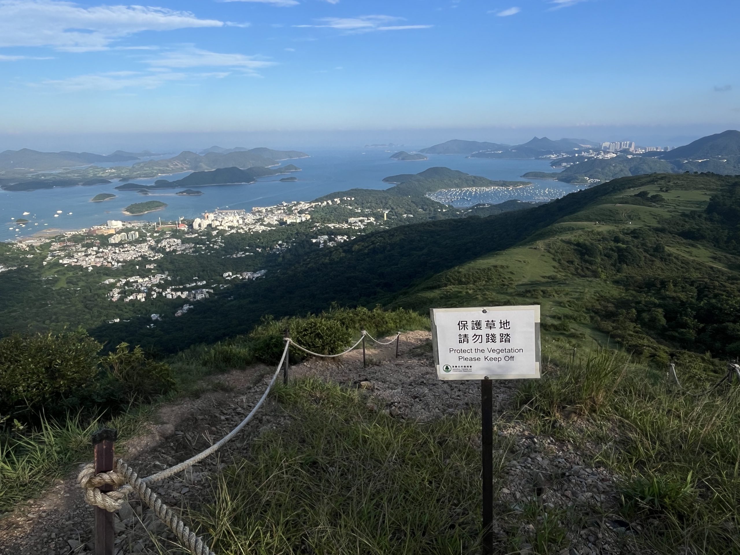
Let’s Leave No Trace
If you want to camp in Ngong Ping, please use official campsites to avoid damaging the vegetation.
Mission 1
In this section of the trail, what Eco-Trail element has been installed to drain away rainwater?
A. Pile of branches B. Water bar C. Settlement Basin
Mission 2
Take a photo with one of the landmarks in the images below
1.Ngong Ping Plateau
2. Ma On Shan Country Trail (the section of eco-trail) Near the pavilion (Introduction point V)
Introduction Point I: History of the Ma On Shan Mining Village
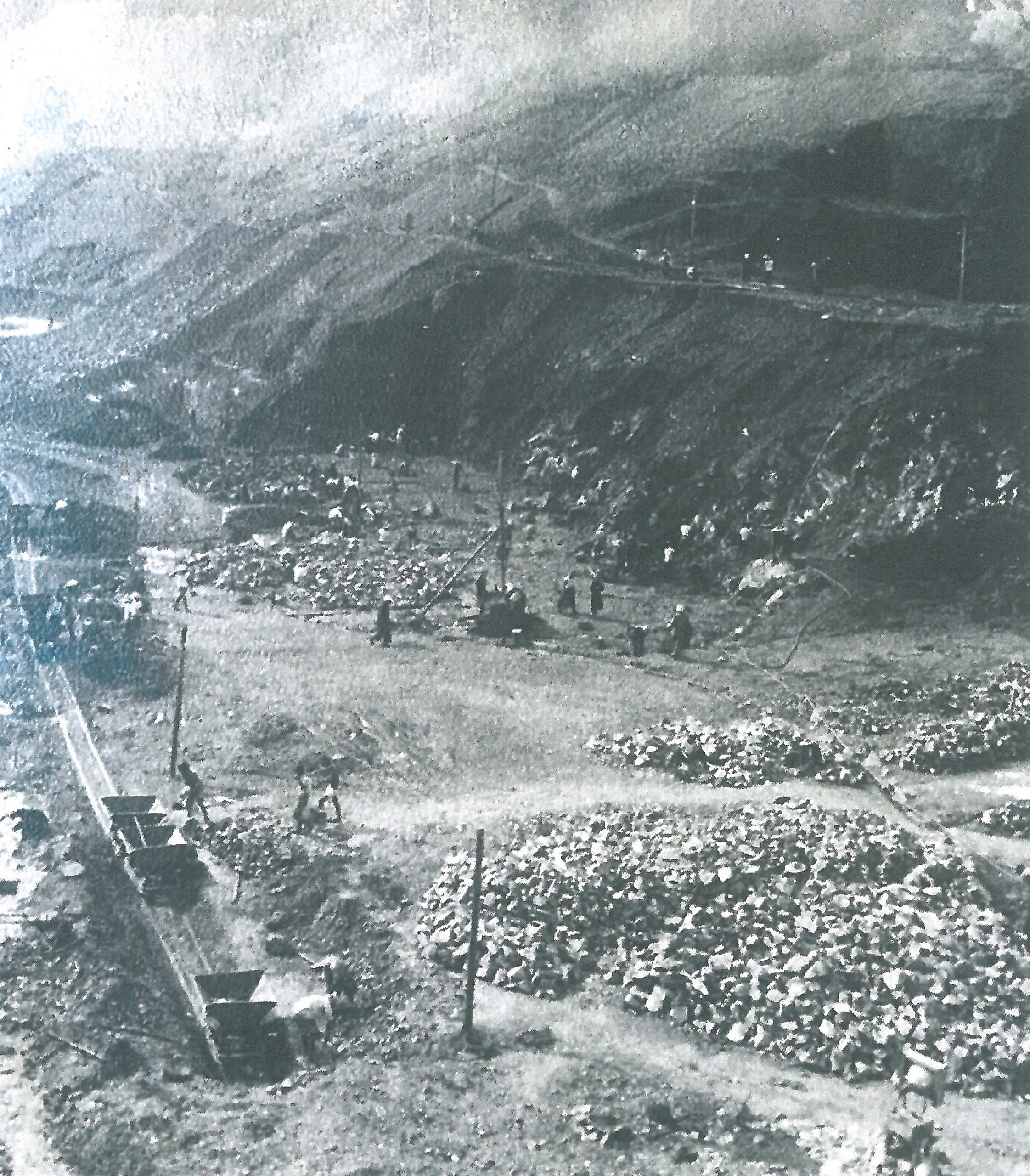
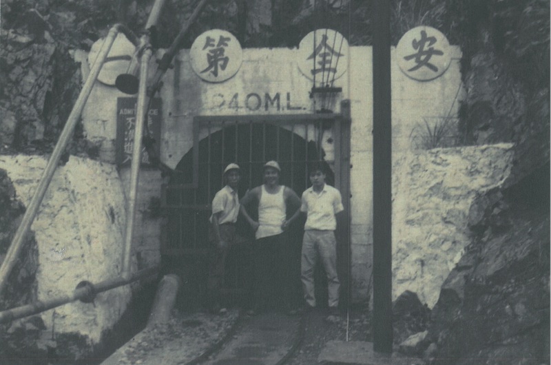
Today, Ma On Shan Country Park is an area of verdant green, but more than 80 years ago, it was a vast, barren iron mine.
In the past, Ma On Shan’s land was infertile and water resource was insufficient, and agriculture development was poor. However, granite intrusion in sandstone and siltstone there formed high quality magnetite and hematite in plenty. Once the largest commercial quarry in Hong Kong, Ma On Shan Quarry had an estimated magnetite reserves of 7 million tons. In the 1950s and 1960s, the Quarry was the only commercially viable iron mine in Southeast Asia and attracted many workers from all over the city to move to Ma On Shan. There were 3,000 miners working in the Quarry in its heyday. The miners and their families built their houses beside the mine, forming a mining village. During the peak period, there were nearly 10,000 people living in the mountain area.
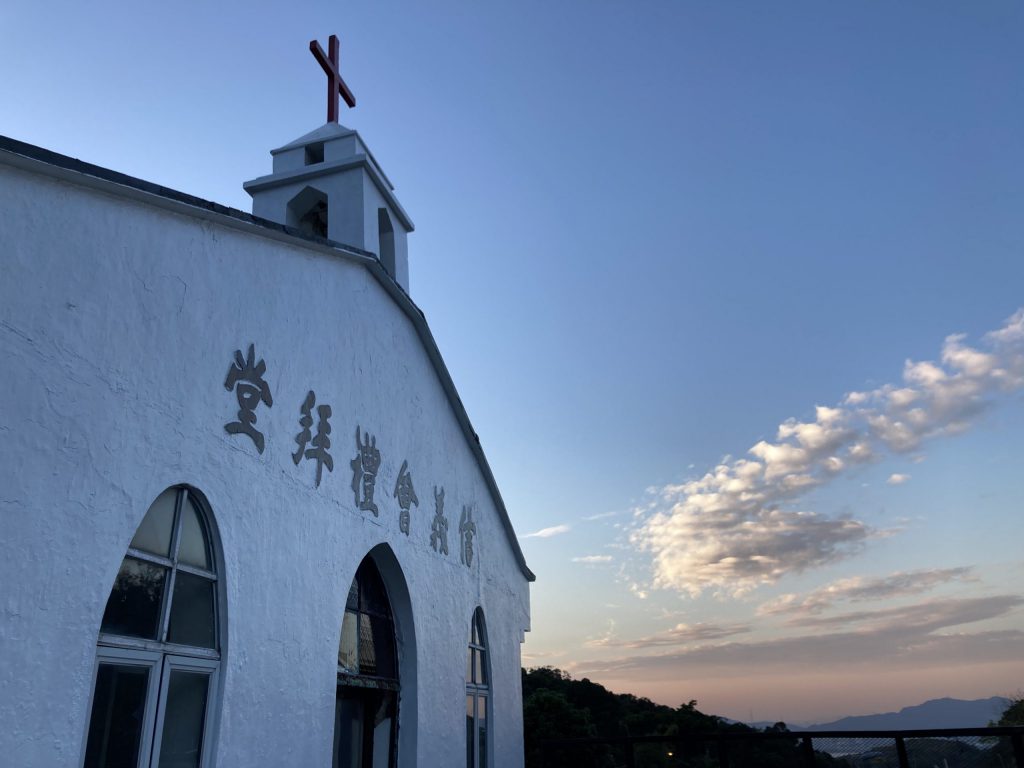
Due to Ma On Shan’s remote location, residents had little contact with the outside world and gradually formed a unique community of its own. At that time, two churches provided the residents, with school education, medical services, and living assistance. The religious buildings, namely the Lutheran Yan Kwong Church and the St. Joseph’s Church, were the landmarks in the village. With the closure of the mine in 1976 and the migration of villagers, the population of Ma On Shan Country Community also slowly aged.
In 2015, Lutheran Yan Kwong Church became the ELCHK Grace Youth Camp. The Camp introduces the history of the Ma On Shan Quarry and the natural ecology of Ma On Shan to the public through exhibitions of past tools and precious photographs of the mine, and guided tours. The café in the Camp provides visitors with a nice resting area and viewing point. The camp is the first venue in Hong Kong operated under ‘‘Mountain Hut’’ concept.
Open quarry
240 M.L. Mine
Lutheran Yan Kwong Church was revitalized into the ELCHK Grace Youth Camp in 2015
Introduction Point II: Shortcut restoration
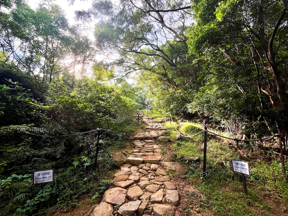
As a popular major trail leading to the Ngong Ping Campsite, Ma On Shan Country Trail is used by many hikers and campers, especially during public holidays.
Some impatient visitors may walk on the vegetation at the corner of the trail. The corner of the path in the picture had been turned into a shortcut, attracting even more visitors to walk on the tree roots. Over time, the soil became compacted and the topsoil was removed by their footsteps, exacerbating the problem of root exposure and ultimately affecting the survival and stability of the trees.
In 2021, the AFCD invited volunteers to begin restoration work. Dried wood and branches were collected nearby to repair the shortcut, while boulders were used to block the entrance and exit to guide visitors back to the original trail. The vegetation can recover only when the corner point is no longer trampled.
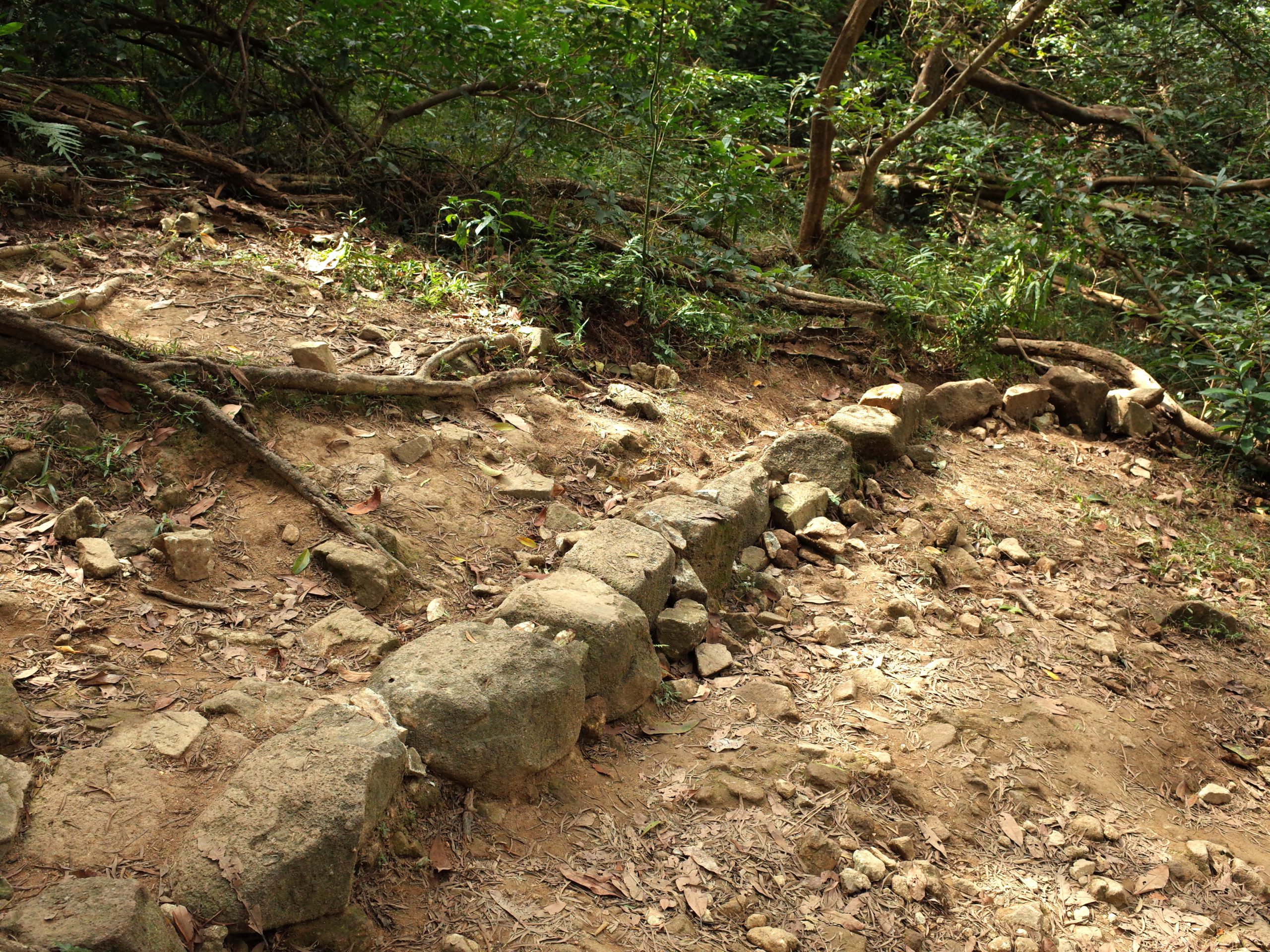
Introduction Point III: Stone-made water bars
After climbing the stone steps, there are two small stone banks in front of the pavilion. These two rows of stones are “water bars”, put in place by the trail masters. Their purpose is to divert the excess water from the upper sections of the trail. This prevents water from running down the slope, eroding the topsoil supporting the stone steps and causing structural damage to the stone steps.
Depending on the availability of natural materials close to the trail, wood can also be used to construct such drainage or diversion structures.
Two “water bars” parallel to each other next to the trail
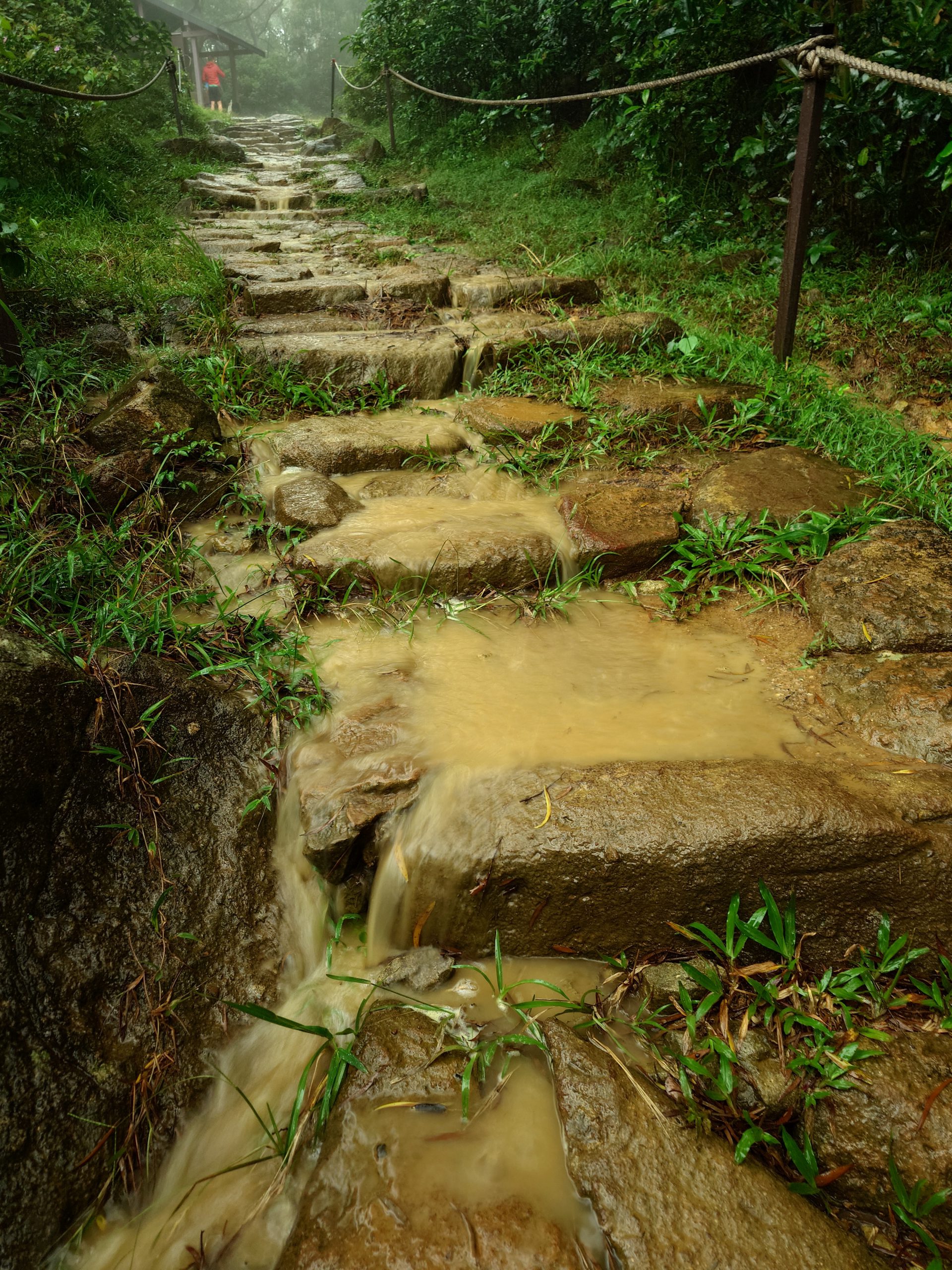
Introduction point IV: Trail runoff at pavilion location
When you reach the pavilion, you may notice traces of trail erosion as you rest. Loss of topsoil in trails can be caused not only by human footprints, but also by water, one of the greatest enemies of trails! Surface runoff is the water that flows over the ground in various forms. On rainy days, water flows along the trails from above and through the Ma On Shan Country Trail. If there are no facilities to divert the water away from the trail, the water can carry away the soil of the trail, causing soil erosion and making the trail uneven to walk on.
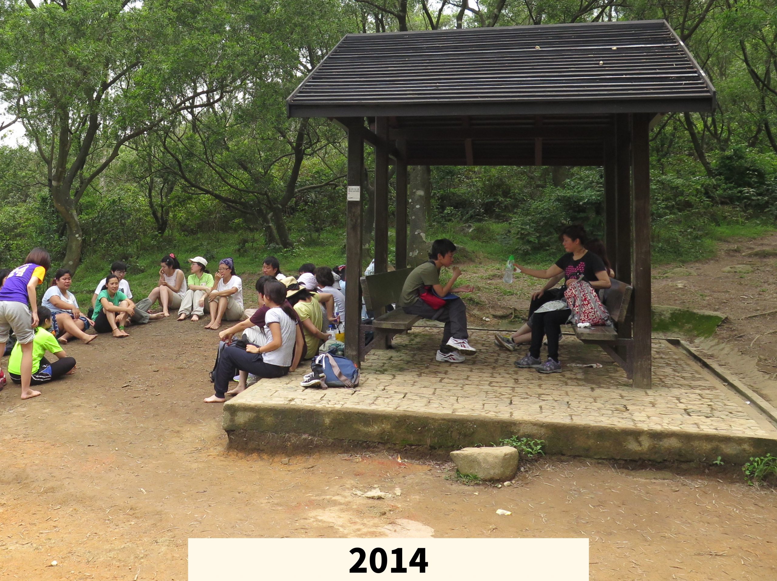
The elevated pavilion?
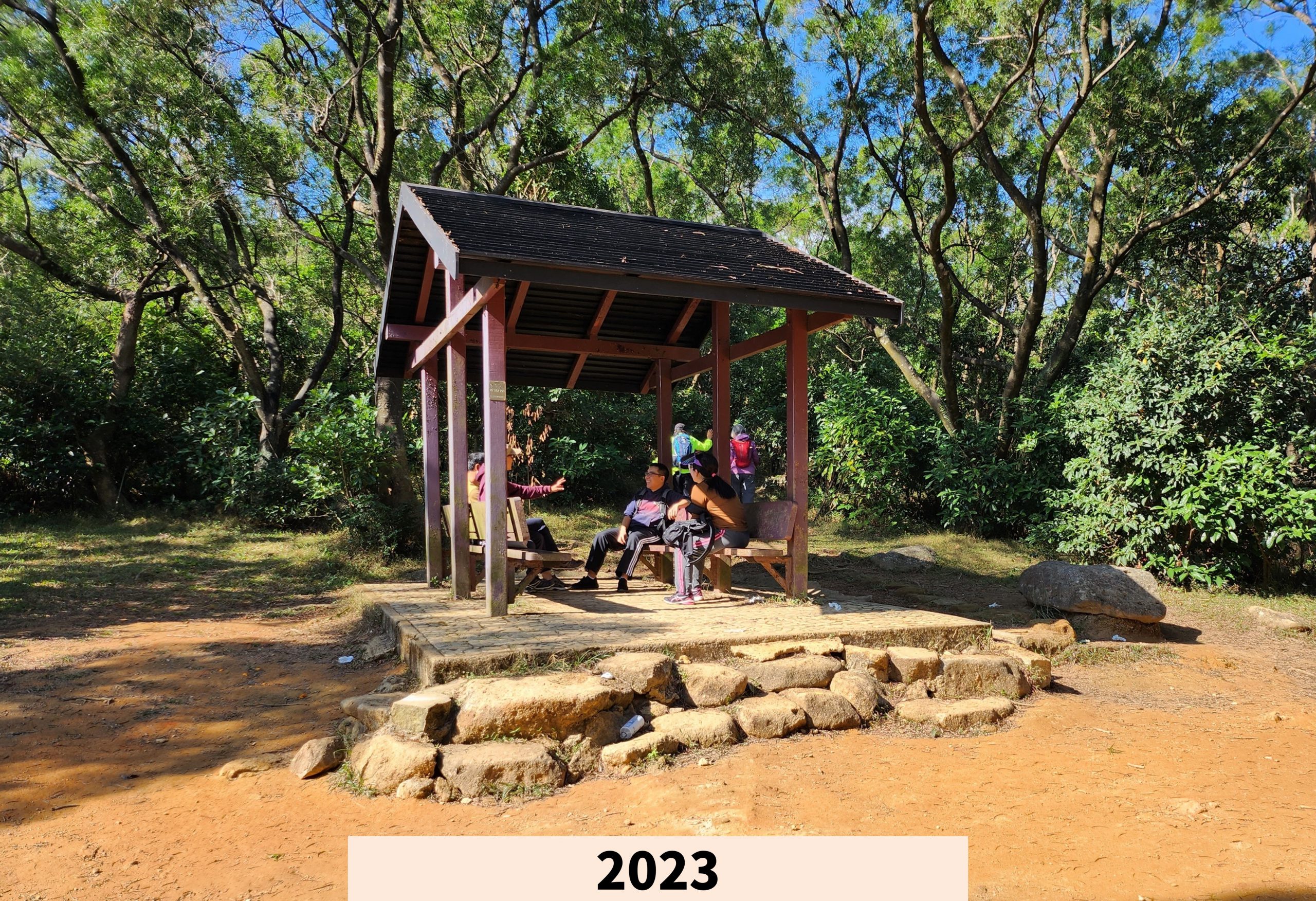
How serious is soil erosion? The answer can be found in a pavilion along the trail. In 2014, the pavilion was just one step above the ground. But by 2023, the gap between the pavilion and the ground had increased due to soil erosion. More stone steps had to be added to make it easier for visitors to enter the pavilion.
Introduction Point V: The exemplary trail restoration
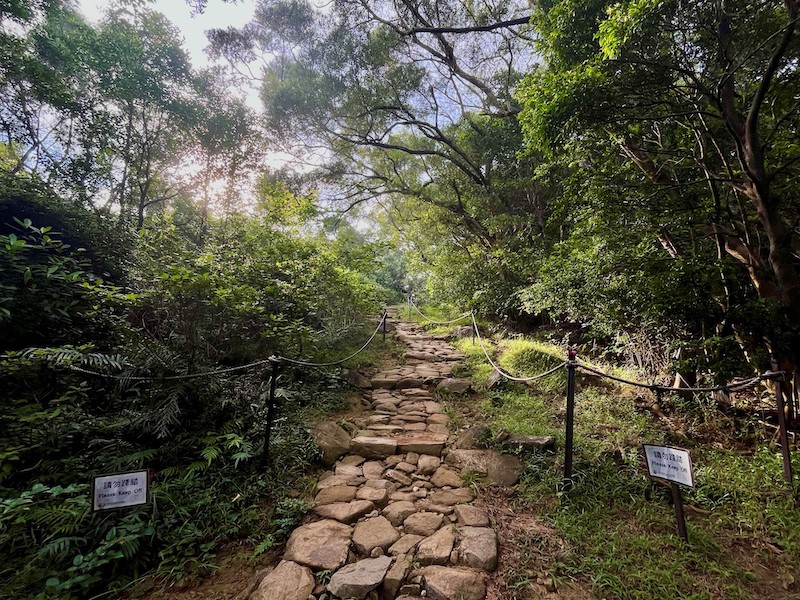
Next to the pavilion, there is a notice board describing the path that has been repaired by the AFCD and volunteers.
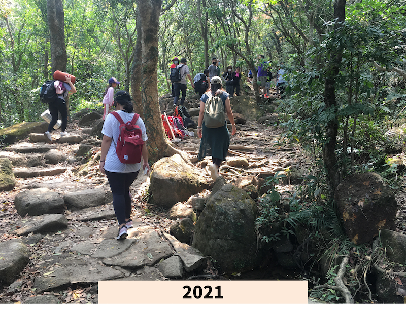
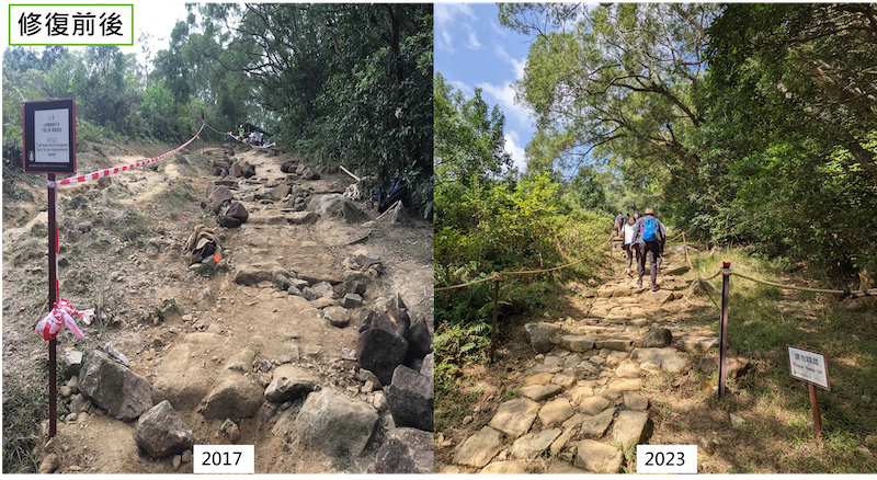
Hong Kong people are increasingly interested in local hiking, especially after the SARS epidemic in 2003. Their pursuit of healthy living and outdoor activities has increased significantly. The Ma On Shan Country Trail is one of the most popular trails. As part of the trail overlaps with MacLehose Trail Section 4, the number of visitors is very high throughout the year.
The junction of the Ma On Shan Country Trail and the MacLehose Trail has always been subject to heavy use and rainwater run-off. For the past three years, the trail has become rough and uneven, making it impassable. Slippery mud made the trail inaccessible, forcing visitors to walk on the grass on either side. The grass on the edges of the trail was trampled to death. After a few more heavy rains, rainwater washed away the topsoil uncovered by the vegetation, widening the trail to nearly 7 metres.
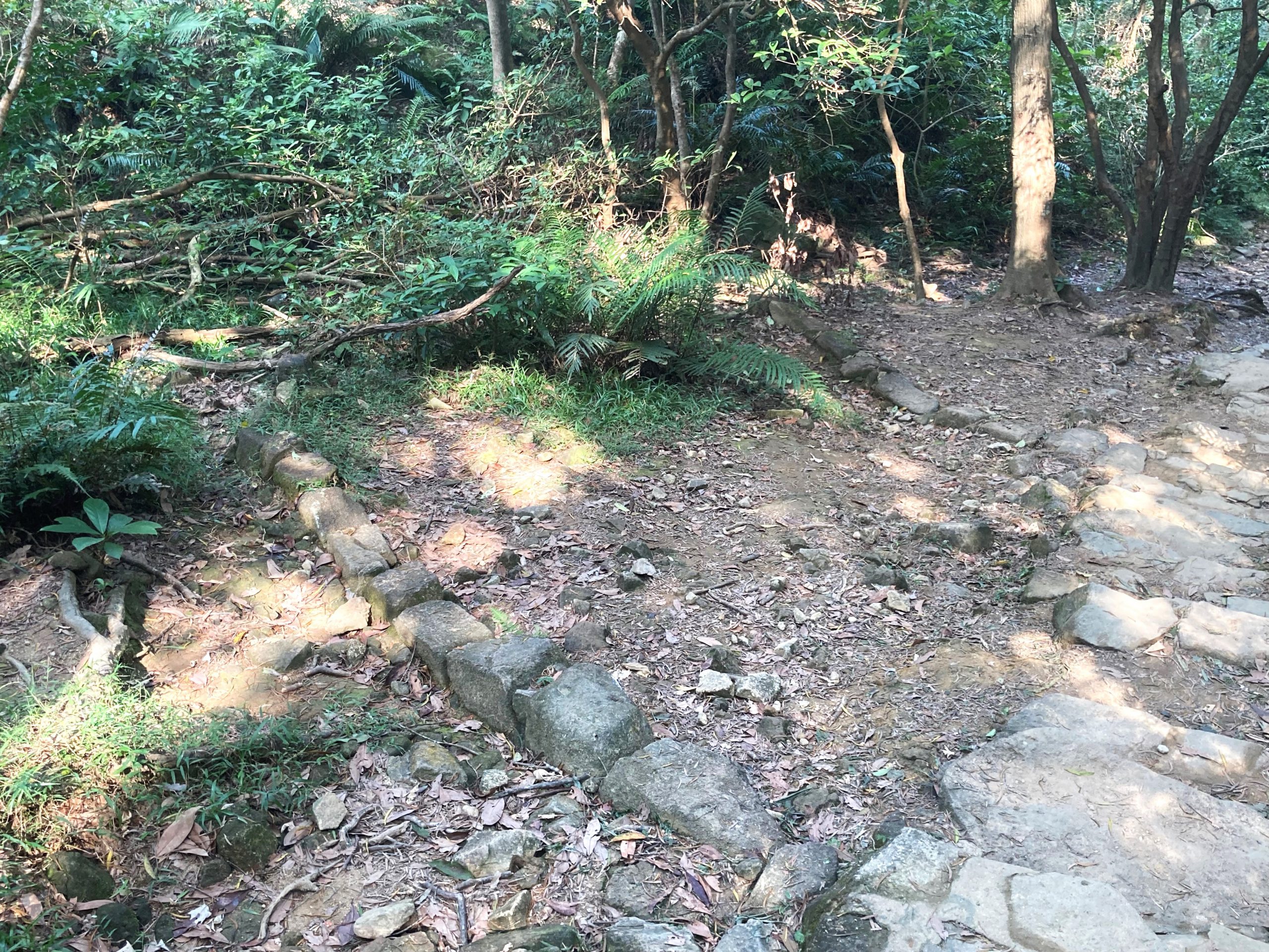
In 2017, AFCD led volunteers to start repairing the path. First, stone steps were made using materials from the surrounding area. Local tree seedlings were planted on both sides to cover and protect the topsoil. To prevent visitors from accidentally stepping on the seedlings, temporary rope railings were installed on both sides of the trail to protect the newly planted seedlings.
The AFCD and volunteers then returned to the site several times to carry out repairs. It took years and a lot of manpower to gradually restore the bare hillside to its former vibrant green! So please remember to “walk the walk”. Do not trample the plants beside the path for your own convenience.
In the summer of 2024, the country trail is once again surrounded by vibrant vegetation.
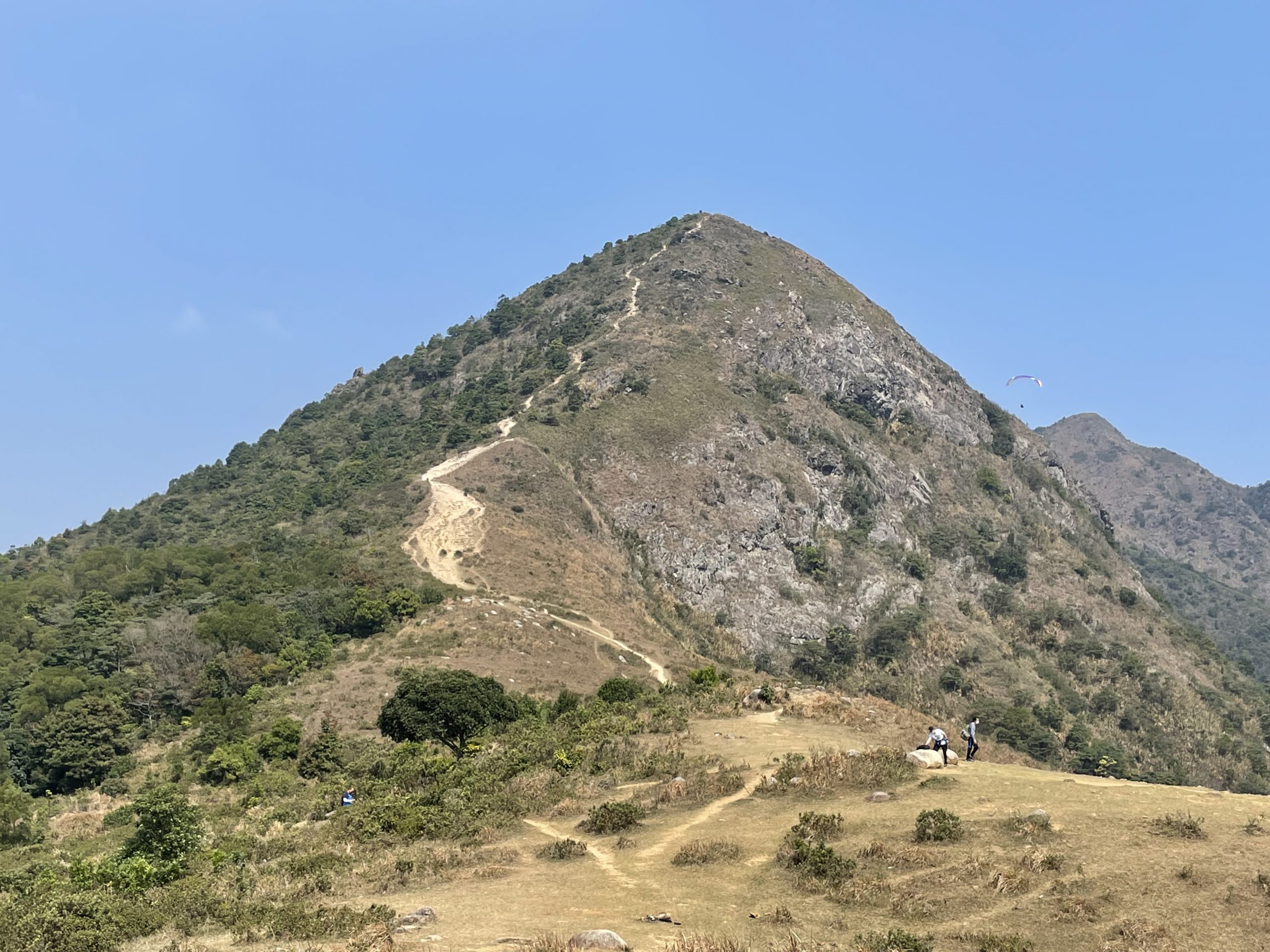
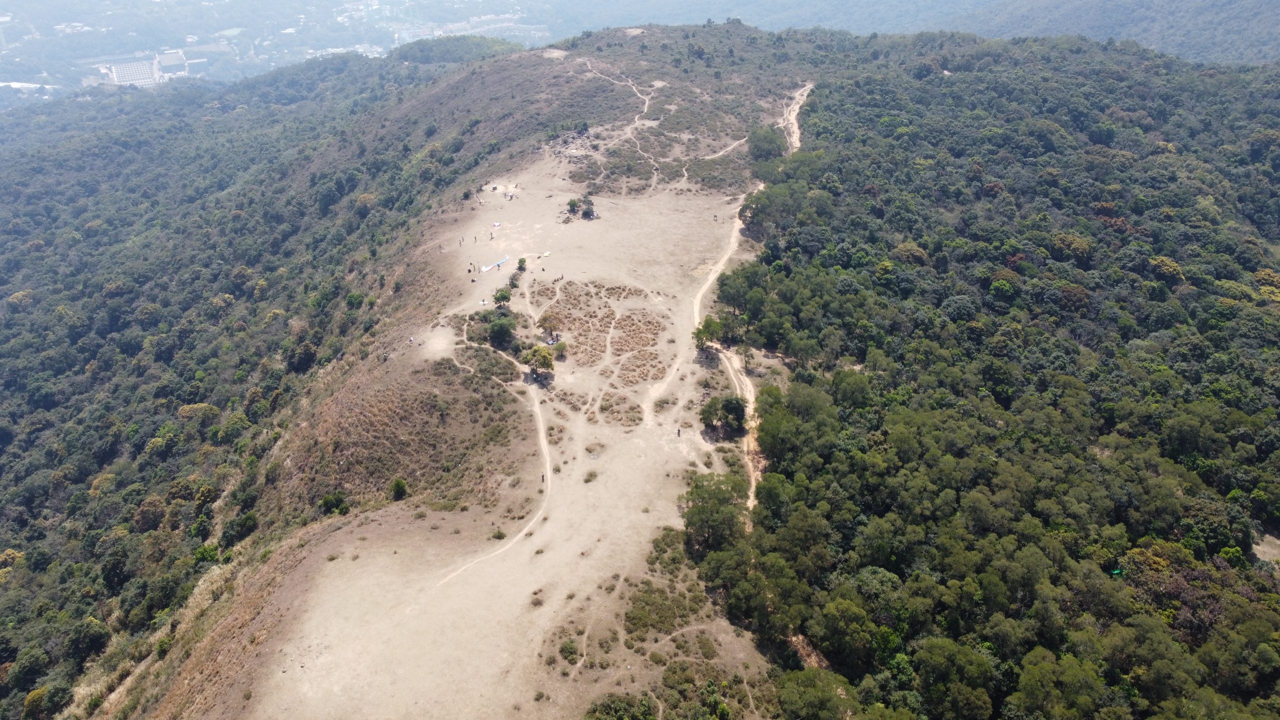
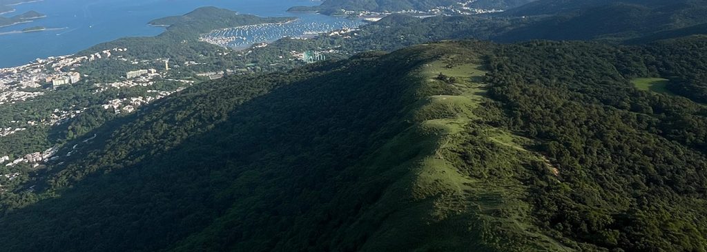
Introduction Point VI: A Bird Eye’s View from Ngong Ping Plateau and the erosion of Pyramid Hill
Ngong Ping Plateau is one of the few upland grasslands in Hong Kong. Standing on the verdant grassland 400 metres above sea level, you can enjoy a panoramic view and recreational activities such as picnicking, camping and paragliding. The nearby MacLehose Trail Section 4 is very popular. During the Covid-19 pandemic, the effects of trampling were severe and the vegetation had little chance to recover naturally. In the photo taken in spring 2022, the vegetation at Ngong Ping is severely damaged. Fortunately, it has regained its lush green due to last summer’s abundant rainfall.
Pyramid Hill is not connected to any official trail, but has become a popular walking spot in recent years. The steep unofficial trail encourages visitors to step on nearby vegetation as they walk downhill, widening the area of bare ground. In order to restore the vegetation, the AFCD installed railings along the slope to enclose the area of the path and give the grass time to regrow. Gradual progress was seen after one year.
The vegetation of Ngong Ping was subject to considerable damage by the visitors in 2022.