“Nature Trail Badge Challenge!” recommends six hiking trail routes for participants to visit and complete designated tasks. These routes are all at locations where The Green Earth’s “Repair Your Own Trails” volunteer team has carried out trail maintenance. We hope that through this activity, more nature lovers in Hong Kong can learn more about the stories behind hiking trails. Hence, spread the achievements of our efforts, and encourage everyone to take action to give back to nature and cherish these trails.
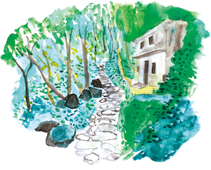
Tai Tong Thousand-Island Lake
The trail starts at Tai Tong Shan Road, with Tai Lam plantations on both sides. As you walk through the forest, you will see how easily the land can be eroded. In recent years, the Department of Agriculture, Fisheries and Conservation has used different methods to repair the area.The ‘Reservoir Islands Viewpoint’ is a popular place to visit, as it offers a great view of Tai Lam Chung Reservoir. Sweet Gum Woods is also a popular destination for red leaf viewing in autumn and winter, and the government website provides information about the red leaves each year to encourage people to visit. The small but scenic Wong Nai Tun Reservoir is also worth a visit.
*Note: Please note that this trail does not pass through Sweet Gum Woods. At the ‘T’ junction between the Tai Lam Forest Track-Tai Tong Section and the Pak Kung Au Section, turn into the Pak Kung Au Section towards the M178 Distance Post of the MacLehose Trail.
Tai Tong Shan Road ➡ Tai Tong Barbecue Site ➡ MacLehose Trail Section 10 ➡ Reservoir Islands Viewpoint ➡ Wong Nai Tun Reservoir ➡ Yeung Ka Tsuen ➡ Shap Pat Heung Wong Nai Tun Tsuen Village Office
Distance: 9.4 km
Duration: 4 hours
Difficulty: ★★★☆☆
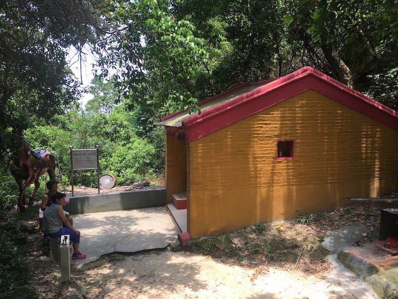
Supply area: Tai Tong BBQ Site No. 1 (Kiosk)
Free Water Filling Station: Tai Tong BBQ Site No. 1 / Tai Tong BBQ Site No. 6
Leave No Trace
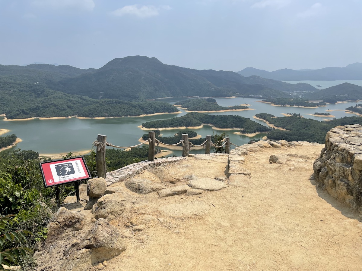
When you visit the Reservoir Islands Viewpoint, do not walk past the fences. Not only is this dangerous, but this would also cause degradation of vegetation on the slope.
Signal of mobile network may get poor at certain sections of this route. Please plan ahead and bring along necessary equipment to secure your personal safety.
Take your litter home. Bring all litter produced during your trip back to the city and handle appropriately.
任務一
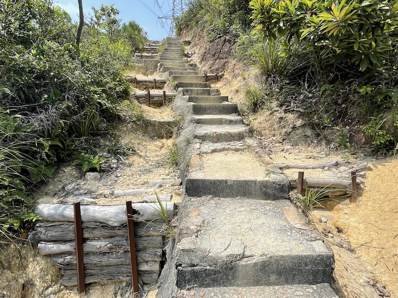
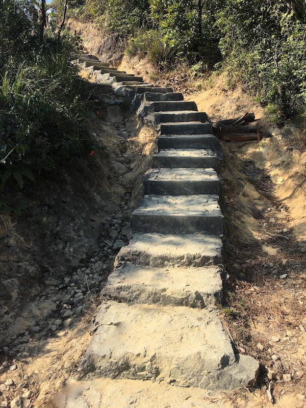
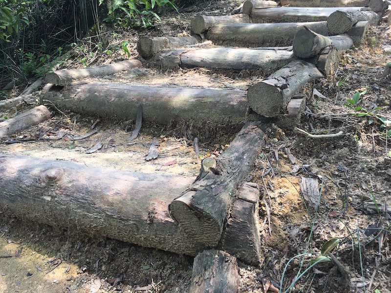
在麥理浩徑第十段(從大棠山道前往清景台一段)的山徑上,你會經過下圖的長樓梯,兩旁共有多少個木製截水壩?
A. 4-5個 B. 6-7個 C. 8個或以上
任務二
與以下指定地標拍下合照
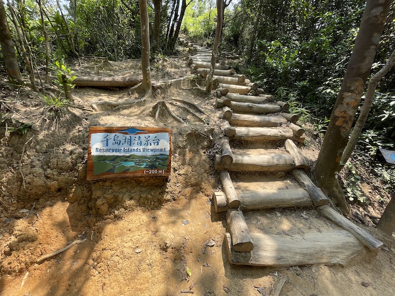
千島湖清景台
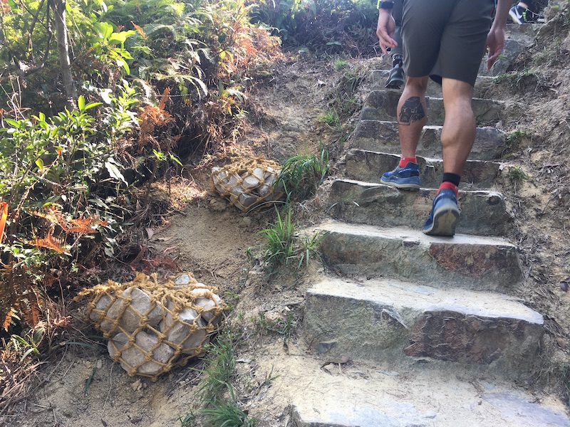
Introduction Point I: Restoration with Netted Rock Assemblages
Tai Tong is made of granite, which doesn’t resist erosion very well and is easily worn away by wind and rain. This is why the topsoil of the hiking trail from MacLehose Trail Section 10 to Reservoir Islands Viewpoint is quite sandy. You can also see signs of people repairing the trail along the way.
Netted Rock Assemblage
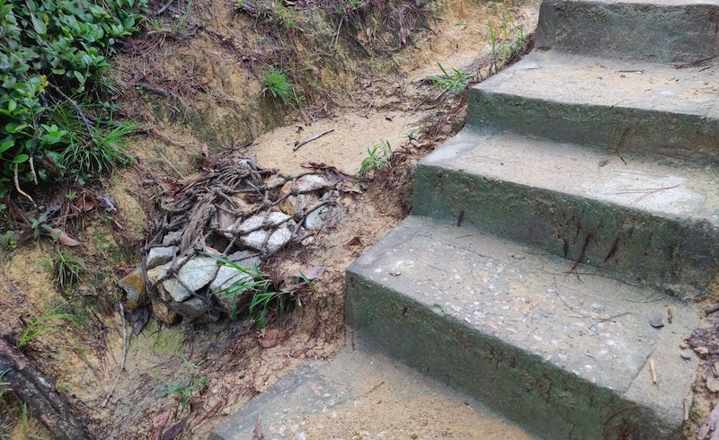
Netted Rock Assemblages are a tool developed by the Department of Agriculture, Fisheries and Conservation’s Trail Masters, and are a low-cost, low-manpower method of restoring eroding gullies. They are made by weaving hemp ropes into a net and placing pieces of stone inside before tying them tightly. The netted rock assemblages are then placed and fixed in the gullies. When it rains, sand and soil are washed down and deposited on the netted rock assemblages. In this way, the lost soil is used to refill eroded gullies, while these assemblages can also act as a buffer to slow water erosion on the mountain paths below.
Restoration with netted rock assemblages in 2019
After some time, soil started to redeposit behind the netted rock assemblages.
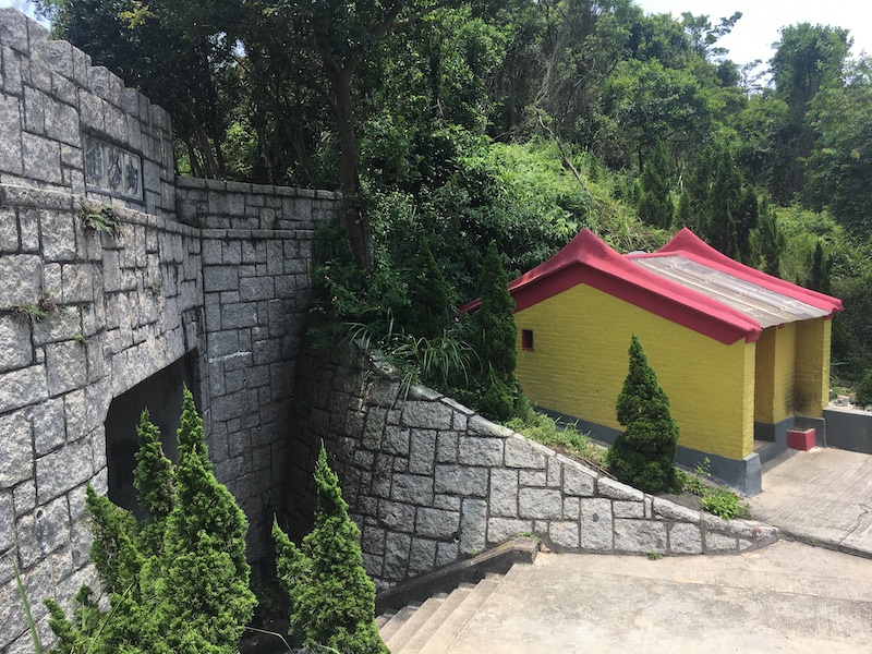
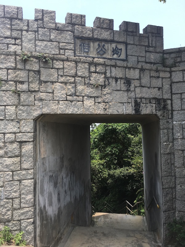
Pak Kung Temple, also known as White Lion Temple, is a small temple built by villagers to pray for road safety. In the past, many villagers lived in three villages, namely Tai Lam Tsuen, Kwan Uk Tsuen and Tin Fu Tsai Tsuen (also known as West, Central and East White Tiger Pass). In order to pray for their safety on their way to and from the market, the people of these villages built three similar temples along the path that most of the villagers walked along.
Even though they are all very small, each of the three temples is different. You can find them on MacLehose Trail Section 10 and Tai Lam Nature Trail. These three temples are still there to protect hikers today.
After the war, Hong Kong’s population grew quickly. There was not enough water for the city, so the government started building reservoirs in Tai Lam Chung. Work started in 1952, and to make way for the reservoirs, villagers from Tai Lam Tsuen, Kwan Uk Tsuen and Tin Fu Tsuen had to move out. Some villagers were moved to San Tsuen and Tai Uk Street in Tsuen Wan, and the three Pak Kung Temples were kept.
Check dams work in a way that is similar to netted rock assemblages, and can be used for larger erosion gullies. They are made of wooden blocks that are arranged into dams. These dams are filled with stones. This helps to protect the area from the impact of heavy rain. It also helps to keep sand in the gullies. This means that they fill up again when it rains.
In 2019, the Agriculture, Fisheries and Conservation Department held workshops to teach volunteers how to make netted rock assemblages and check dams. These structures are used to help restore the erosion gullies on both sides of the hiking trail. However, a lot of sand has now been deposited in the gullies again.
Before restoration
After restoration, sand has redeposited behind the check dams, covering the stone pieces used for making the dams (photographed in 2023)
Introduction Point IV: Reservoir Islands Viewpoint – Handmade Stairsteps
The Reservoir Islands Viewpoint was built by the Agriculture, Fisheries and Conservation Department in 2019. From there, visitors can see a great view of Tai Lam Chung Reservoir. This reservoir has the fourth largest storage capacity in Hong Kong and it was the city’s first reservoir built after the war. It was built between the Tai Lam Chung Valley where there are dozens of little hills. Although the valley was flooded, the hilly peaks remain above the water, creating a beautiful view of the many scattered islands. This is why the reservoir is also called ‘Hong Kong’s Thousand Island Lake’.
To keep in tune with nature, trees that have fallen during typhoons have been used to build the path to the Reservoir Islands Viewpoint. A traditional Chinese way of building, called mortise and tenon joints, has been used in some parts of the path, where no nails were used to hold the logs together.
Introduction Point V: Reservoir Islands Viewpoint – Leave No Trace
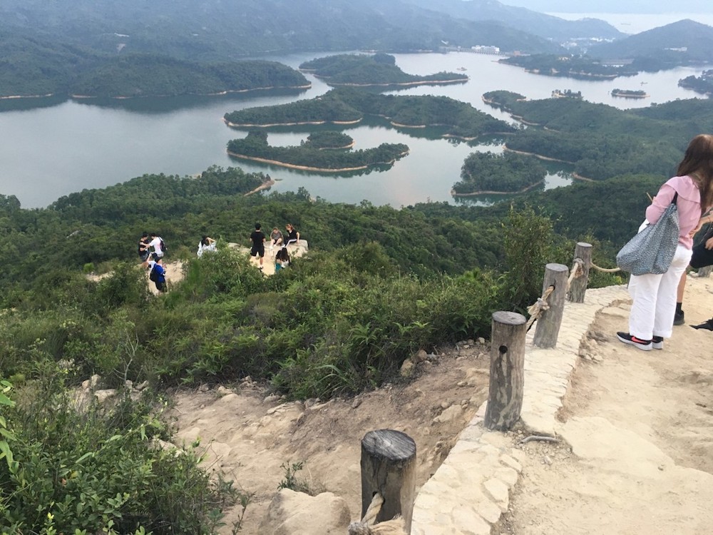
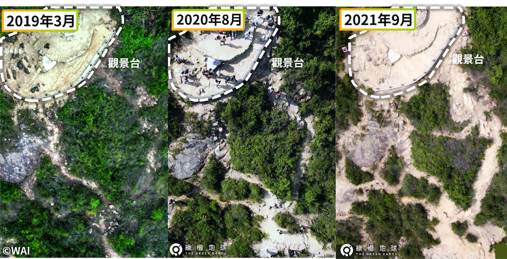
The Reservoir Islands Viewpoint is a popular tourist destination and photo spot. It is located next to the Tai Lam Chung Reservoir. However, more and more tourists are visiting, and some visitors want to take the best pictures without being blocked. So, they start to walk past the fences and trample into the shrubs.
From pictures taken from the air of the Viewpoint, it is easy to see how the land across the fences has changed over the years – the paths are becoming more obvious and wider, while the plants are getting smaller. These paths are becoming so clear that more visitors are being tricked into crossing the fences and walking on the hillside, which means there is a greater chance of accidents. The plants are also being damaged more by people walking on them, which makes the problem of soil erosion worse.
Stay on the path when you are hiking or taking photos. Do not go off the trail or create shortcuts. Do not damage the plants or animals. This will help to protect the beauty of the scenery.
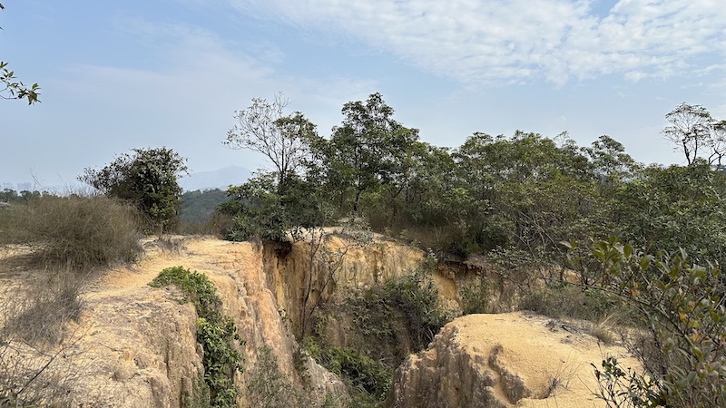
Wong Nai Tun Reservoir is a small but beautiful pond that supplies water to farmers. It is a beautiful turquoise colour when sunlight hits it and was built in the 1960s.The government wanted to increase the water supply of Tai Lam Chung Reservoir. To do this, it stopped some of the water from nearby rivers. This meant that there was less water flowing through Yuen Long and further downstream. This affected the supply of water for farming. So, the authorities decided to build four more reservoirs to provide water for farming in the area. Wong Nai Tun Reservoir is one of these.
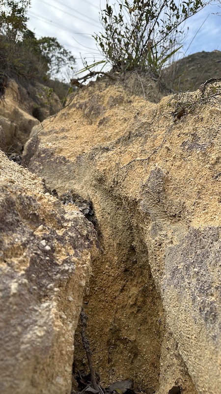
If you go hiking between Wong Nai Tun Reservoir and Wong Nai Tun Tsuen, you can see how the granite rocks have caused soil erosion. The gullies have got deeper over time, and the deepest part is now one storey deep.
Later, the government started planting lots of trees on this barren mountain. Tree roots hold soil together, so it doesn’t get washed away by rainwater. At the same time, leaves and branches that have fallen off turn into new soil, which helps to solve the problem of soil erosion.
Soil erosion in the area near Wong Nai Tun Reservoir. (Photo Credit: @hkallshan)
Some gullies can be over one-story deep. (Photo Credit: @hkallshan)