“Nature Trail Badge Challenge!” recommends six hiking trail routes for participants to visit and complete designated tasks. These routes are all at locations where The Green Earth’s “Repair Your Own Trails” volunteer team has carried out trail maintenance. We hope that through this activity, more nature lovers in Hong Kong can learn more about the stories behind hiking trails. Hence, spread the achievements of our efforts, and encourage everyone to take action to give back to nature and cherish these trails.
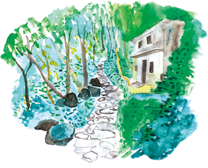
Mau Ping Ancient Trail
According to Mr Kwok Chi-biu, a veteran researcher of ancient trails, the trail connecting Mau Ping and Pak Kong is part of the Sai Sha Ancient Trail. This trail was used by villagers to travel to and from Sai Kung and Siu Lek Yuen in the past. Nowadays, two well-known trails – Mau Ping Ancient Trail and Pak Kong Ancient Trail – still have their original stone steps and ridges, where the big rocks are covered in moss.As you walk along these trails, you will find yourself in a completely natural environment.
In Mau Ping, you can choose to hike along the Pak Kong Ancient Trail. On your way, you’ll pass through Uk Cheung Village and the famous bamboo grove. After arriving at Pak Kong Au, you’ll find multiple ancient trails of different types. This shows how well the ancient network of trails was developed. Please remember that you need to do some research to find the right route and read a map before you go hiking, as people sometimes lose their way in the network of trails.
Mui Tsz Lam road➡ Mui Tsz Lam➡ Mau Ping San Uk➡ Lau’s Ancestral Hal➡ Mau Ping Au➡ King of Gogovine
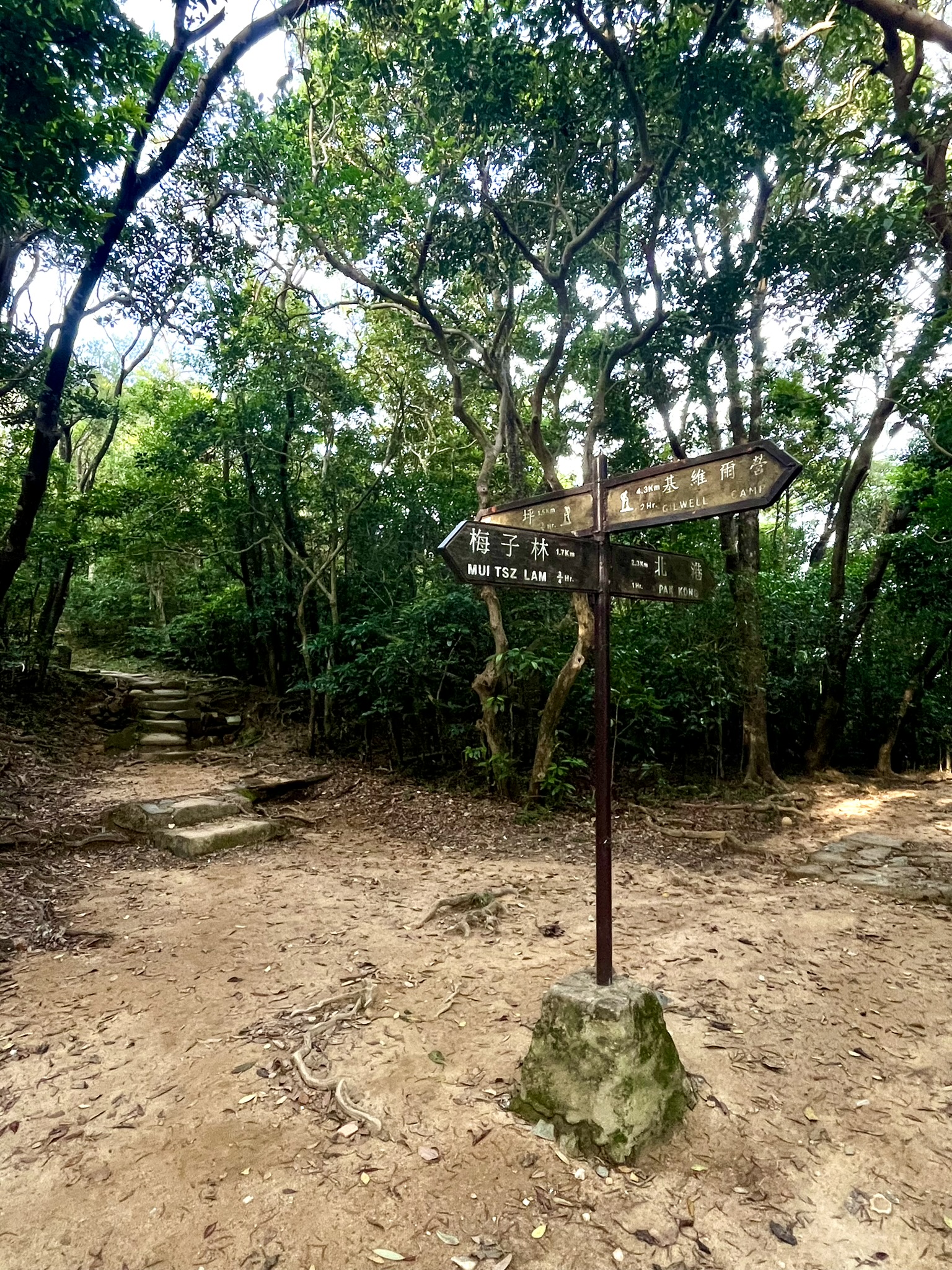
You can pick either route when arriving at Mau Ping Au:
1.➡ Pak Kong Ancient Trail➡ Pak Kong Au ➡ Hiram’s Highway (2.3km)
You may also
2. ➡ MacLehose Trail Section 4 (reverse direction)➡ Ngong Ping➡➡ Ma On Shan Country Trail➡ (3.1km to leave at Ma On Shan Village)
You can also chose a longer route:
3. ➡ MacLehose Trail Section 4➡ Gilwell Campsite and Sha Tin Au (9.3km)
Distance:4.1 km (Arriving at Mau Ping Au only)
Time: About 2 hours
Difficulty:★★☆☆☆
Supply Point:
No supply point on the way
Let’s Leave No Trace
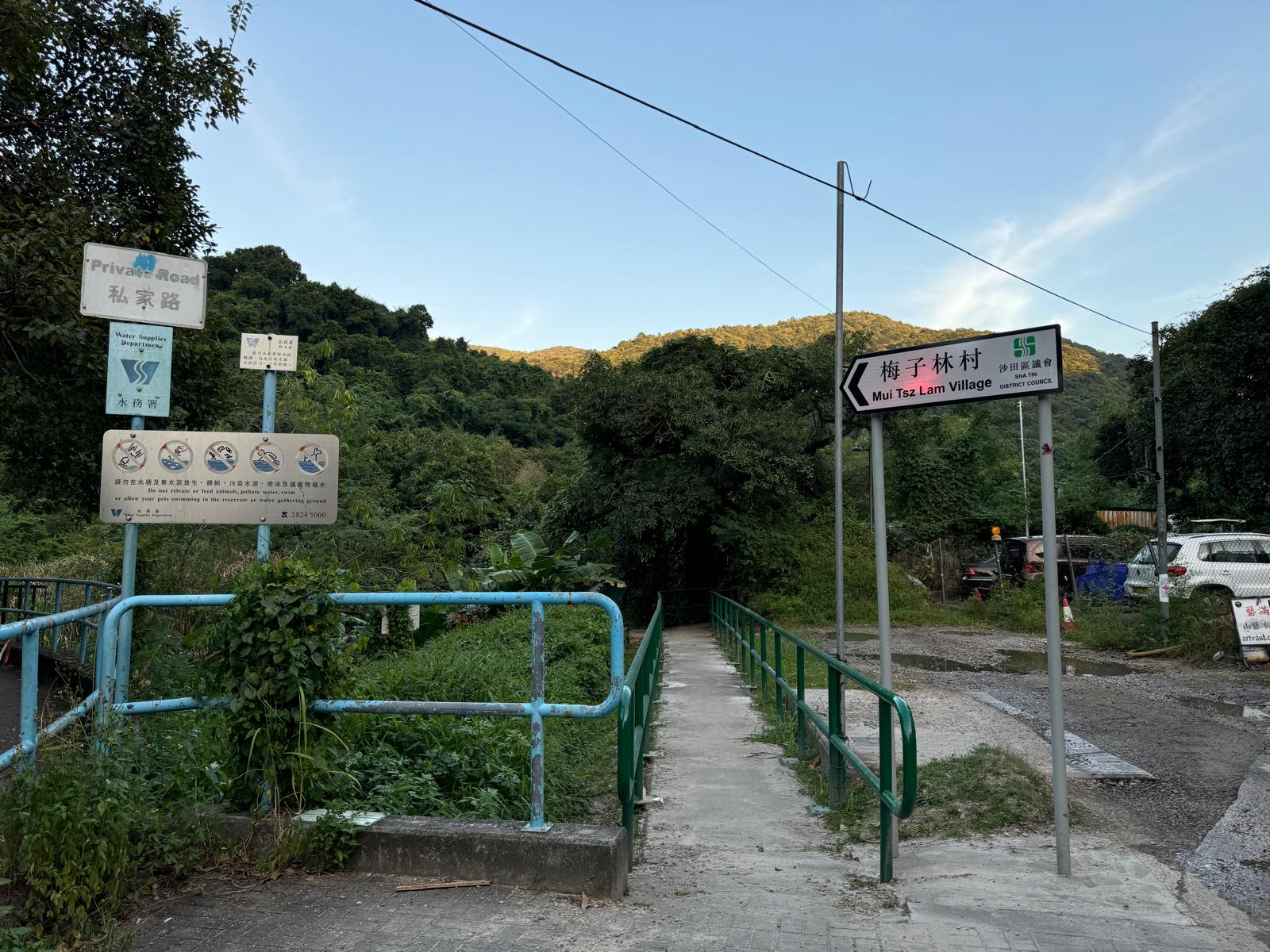
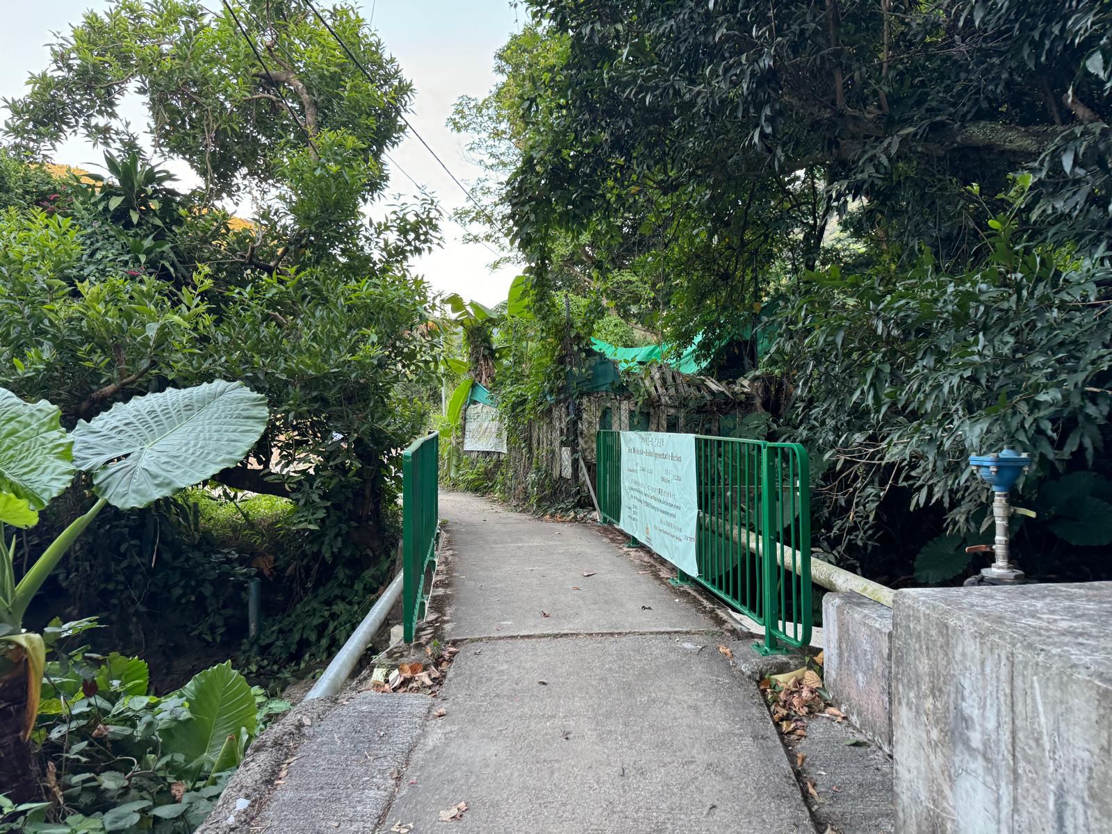
To get to Mui Tsz Lam, walk down Mui Tsz Lam Road. Try not to go through Chevalier Garden so as not to disturb the people living there.
Some parts of the road might not have phone signal. Please plan ahead and make sure you have everything you need before you set off to stay safe.
Please take your rubbish home. Any rubbish that you make while hiking or on other trips should be taken back to where you live so that it can be thrown away properly.
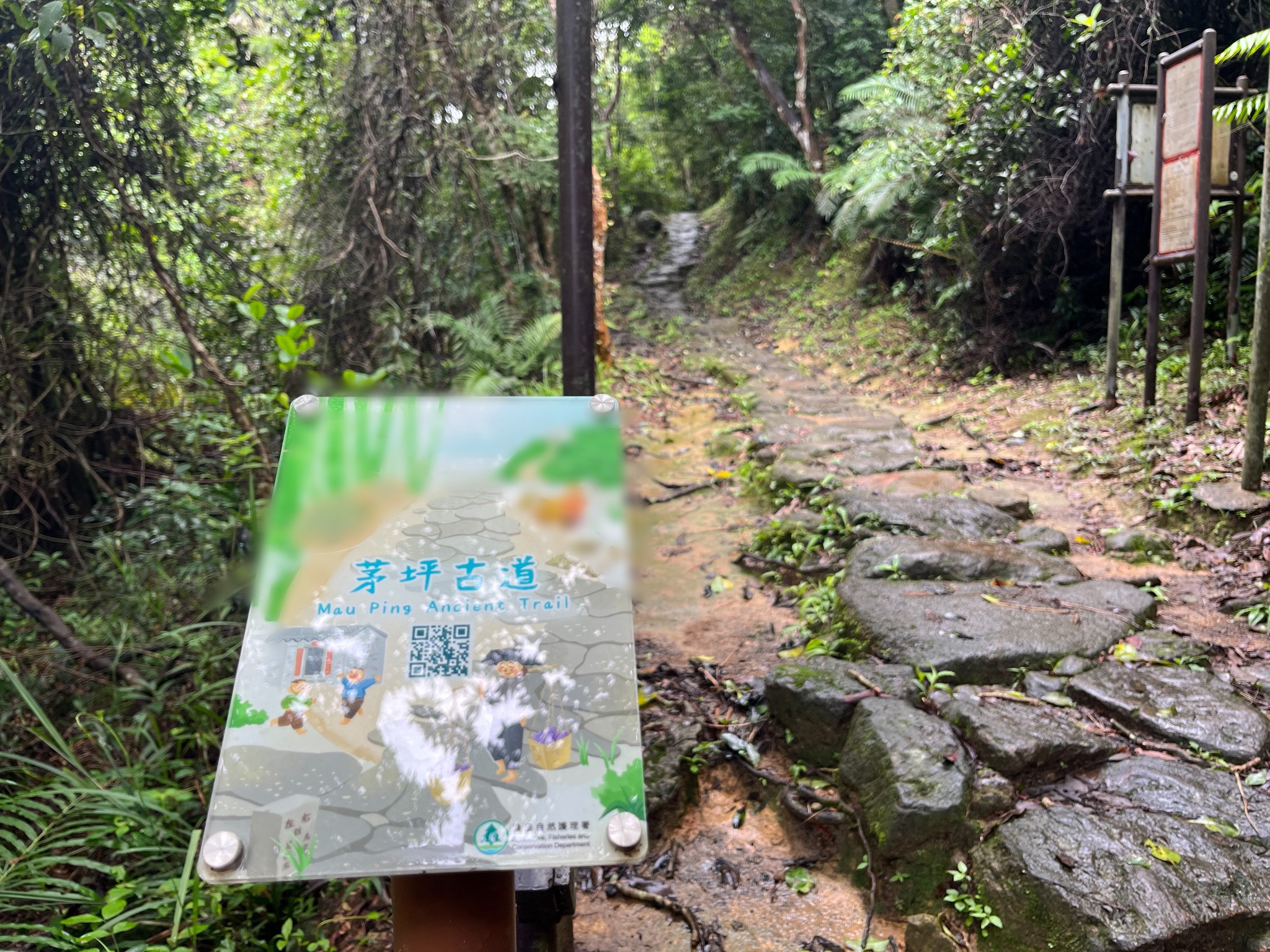
任務一
路線開始不久,會見到漁農自然護理署「茅坪古道」的牌子(如下圖),牌上卡通畫了哪種食物?
A. 香蕉 B. 麵 C. 茶果
任務二
與以下其中一個指定地標拍下合照
1.藤皇
2.茅坪古道
Introduction Point I: Mui Tsz Lam Fung Shui Woodland
The route starts at Chevalier Garden. To warm up, walk along Mui Tsz Lam Road. After about 2 km (30 minutes) of walking uphill, the road becomes flat. Before you reach the Water Supplies Department gate, look for the sign for “Pei Tsz Lam Village” and enter the trail.
This route does not lead to Mui Tsz Lam Village. Just walk a little further to the farm gate. On the left, you’ll see a concrete path. Follow the path along the farm’s iron fence to reach the entrance to the Mau Ping Ancient Trail.
When you arrive at Mui Tsz Lam Village, you will see that the village is surrounded by hills on three sides, with an open space in front. This is how the Hakka people would decide if a place was good for building their village. They believe that this is a “Fung Shui paradise”. They also believe that planting fruit trees on the hills at the back of the village can help protect it from typhoons, keep the temperature regulated and prevent soil erosion.
Fung Shui Woodland is a unique cultural landscape that originated in the Lingnan area. In the past, people’s daily lives depended almost entirely on the laws of nature, so they held nature in awe and believed in Feng Shui numerology. There are more than 300 Fung Shui Woodlands in Hong Kong, although only 116 are officially registered. As well as mitigating seasonal temperature extremes, Fung Shui Woodlands also have an economic value. Villagers grow their own fruit trees and medicinal plants to provide food as well as timber for construction and firewood. “Fung Shui Woodlands also support the survival of wildlife.
Introduction Point II: Mau Ping Ancient Trail
The Mau Ping Ancient Trail, which connects Mui Tsz Lam and Pak Kong, was the main route for villagers to travel between Ma On Shan and Sai Kung. This ancient trail is at least one hundred years old.
According to an online article written in 2018 by Dr Yip Tak-ping, president of the Hong Kong History and Culture Society, Mr Xu Yongqing of Lek Yuen Shek Kwu Lung village wrote a poem in the late Qing dynasty called ‘Wei Ming Gei’, which contains five lines praising the five villages near Ma On Shan:
Walking through the Mui Tsz Lam, you will not notice that you have already reached Mau Ping, where you are surrounded by curiosities. Don’t be intimidated by the height of Wong Chuk Shan.
Trace your path at Shek Lung Tsai; walk up Ngong Ping to catch earthworms. When you turn back to look at the Ma On Shan hilltop, you will be surprised to see the moon hanging in the sky.
Five villages are mentioned in the poem, including Mui Tsz Lam, Mau Ping, Wong Chuk Shan, Shek Lung Tsai and Ngong Ping – a sign that there used to be many villages in the area.
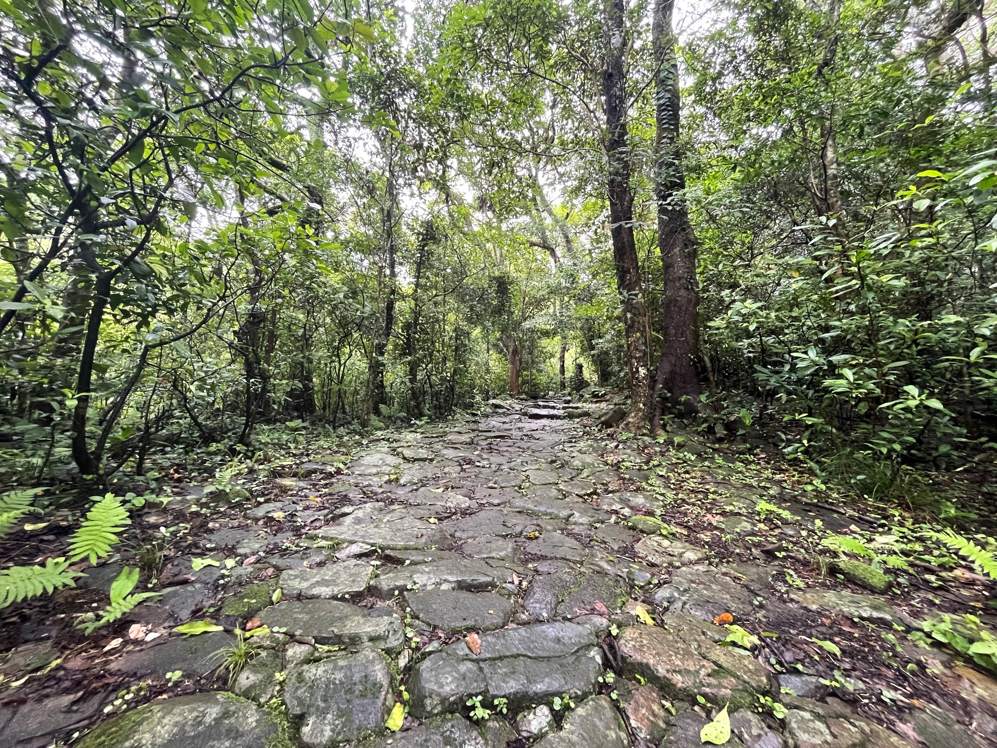
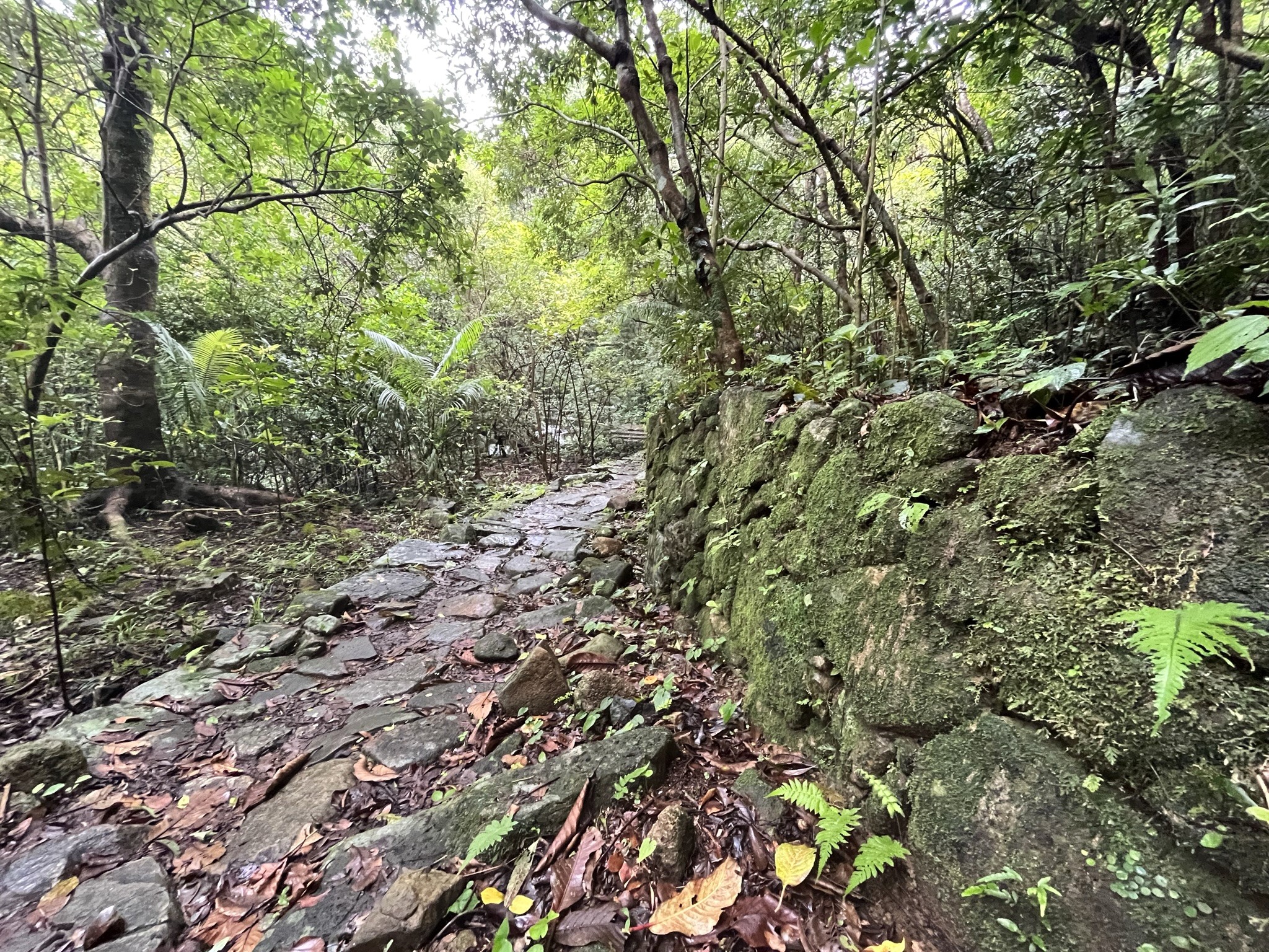
Built by the villagers with local materials and stones in irregular shapes, this path can be considered an ancient “handmade path”.
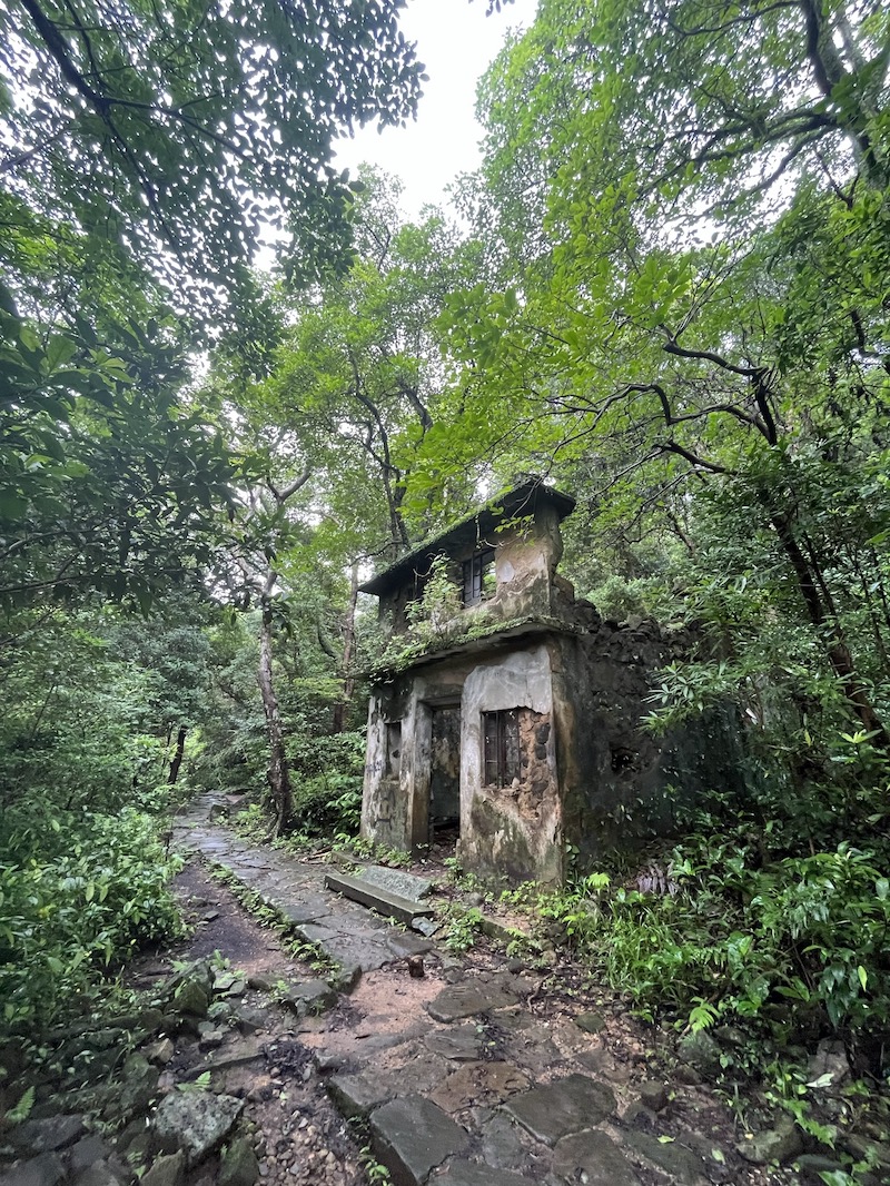
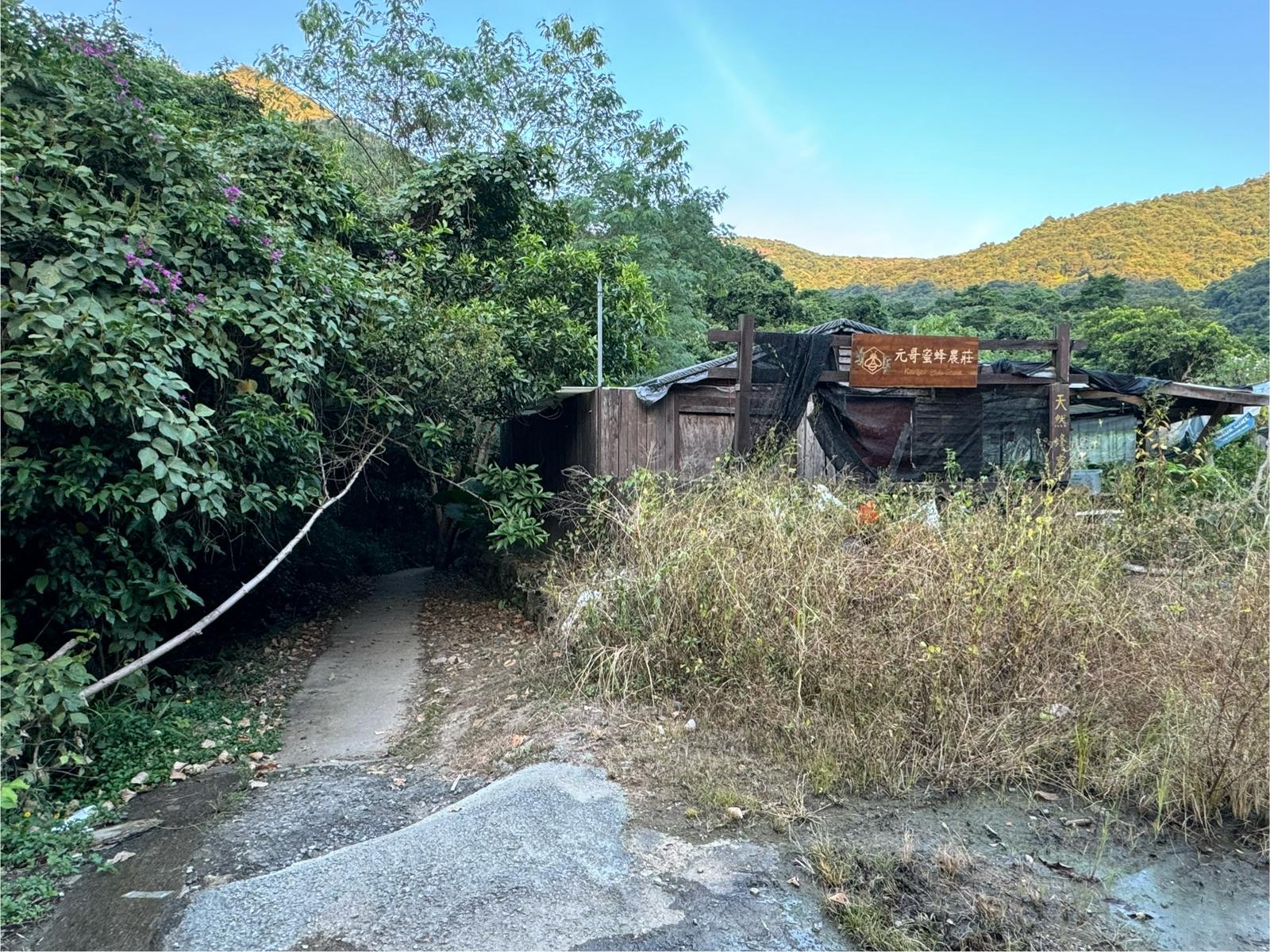
Along the way, you will see Mau Ping cottages that have been abandoned for years. You can imagine how villagers used to travel along this ancient path and cook in their homes.
Along the way there are traces of architectures where villagers used to live in the past
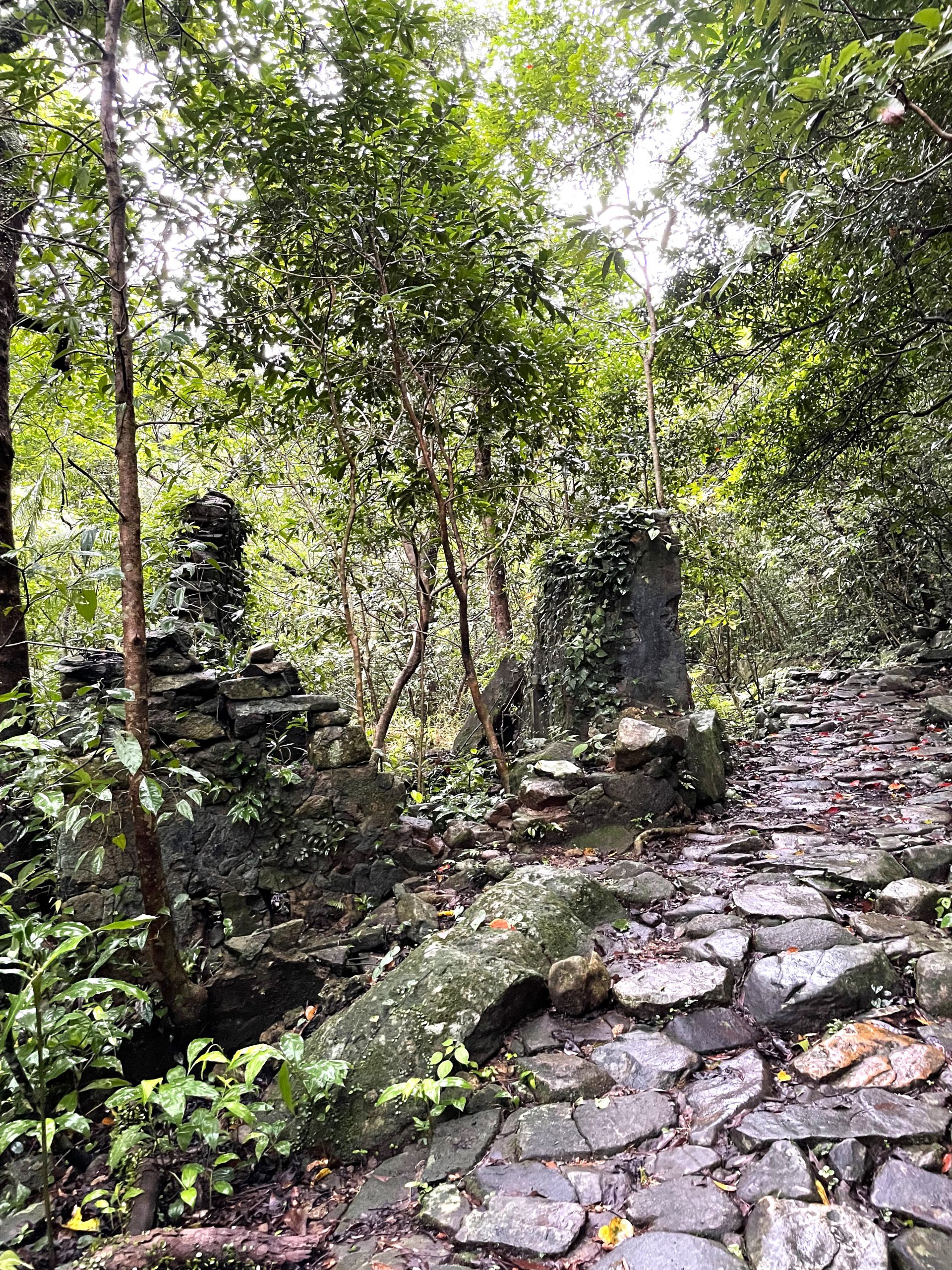
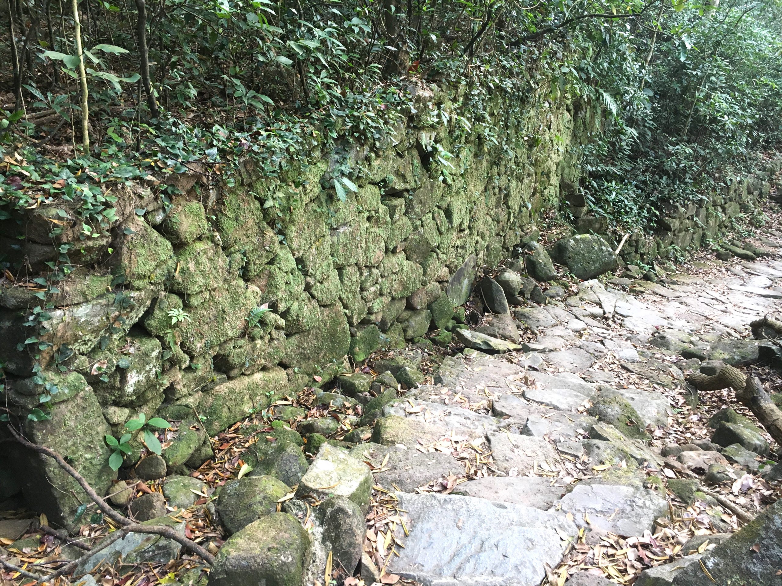
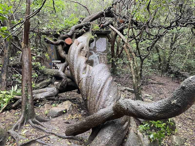
Introduction Point III: Ancient Stone Paths and Walls
As you walk along these ancient stone paths, you will be amazed at the craftsmanship of the ancient people who used stone materials. Take the example of the Lau clan in Mau Ping, who are believed to have settled in Mau Ping over 200 years ago. Although the stone steps (paths for walking uphill) between the villages there have a long history, they are still in use today.
Ancient paths were often built with a slight incline, accompanied by stone steps with little difference in height. This would save the villagers having to walk with heavy loads on their shoulders. Although the shapes and sizes of the stones vary, the paths made from them are still very smooth and flat. Even though no cement was used to fix the 2 metre high stone wall next to the path, it is still very strong.
The surface would be slippery after rain, so hikers need to be extremely careful. The stones are covered with moss and raindrops make them look even shinier and greener!
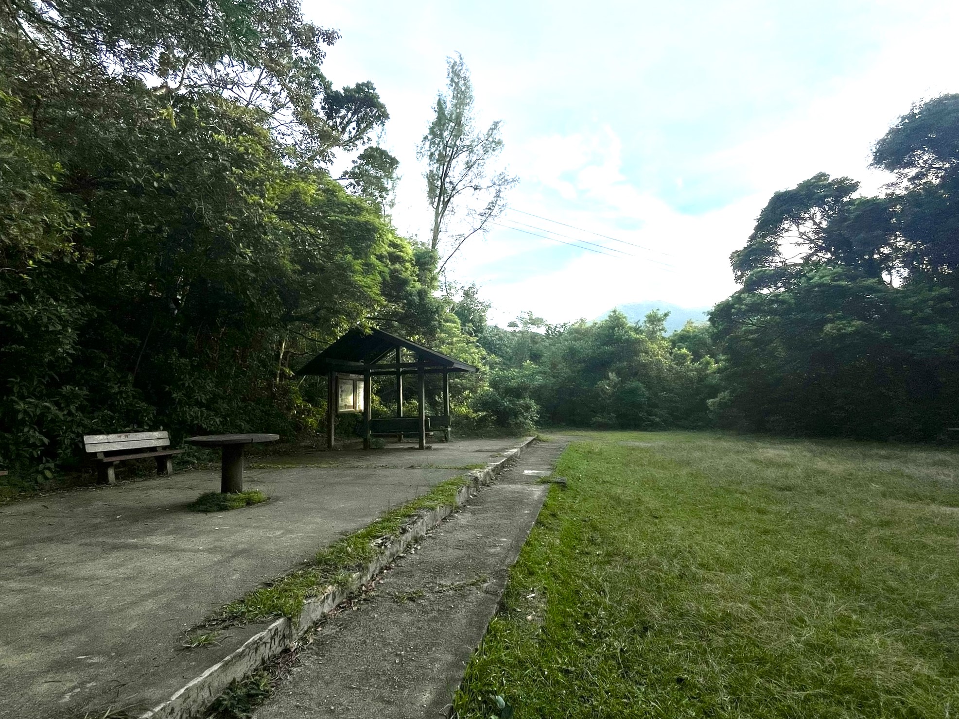
Introduction Point IV: Mau Ping Au Luen Tat Five Heung Public School & Mau Ping ‘‘King of Gogovine’’.
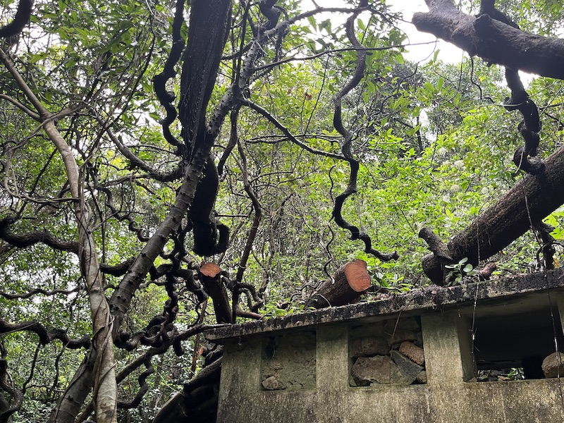
Mau Ping Au is the junction of several walking trails, including the MacLehose Trail, Mau Ping Ancient Trail, Pak Kong Ancient Trail and Shek Lung Tsai Ancient Trail. There is a large foundation with only a pavilion and a few benches. Have you ever wondered why so much time and effort went into building such a large cement foundation just for these facilities?
In fact, it was the foundation of the Luen Tat Five Heung Public School, which was built in the 1950s and 1960s. Children from the villages of Ngong Ping, Shek Lung Tsai, Mau Ping, Wong Chuk Shan and Mui Tsz Lam attended this school.
There is an abandoned public toilet in the woods next to the school where a huge vine is growing. With its impressive shape and rare size, the plant is known as the “King of Gogovine”. It has been a popular photo spot for many hikers. Unfortunately, in June 2023, all of its main trunks were cut off. Now we can only hope that the King of Gogovine will recover naturally.
A rare and famous botanical landmark in Hong Kong was lost due to the selfishness of hatred people.
From here, it is recommended to head towards Pak Kong, follow the Pak Kong Ancient Trail, pass through the bamboo forest and Pak Kong Village, and exit onto Hiram’s Highway.
The site used to be Luen Tat Five Heung Public School
The main trunks were all but cut off.
MTR Tuen Ma Line
B exit of the Tai Shui Hang Station,walk about 8 minutes to Mui Tsz Lam Road